Construction
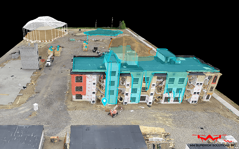
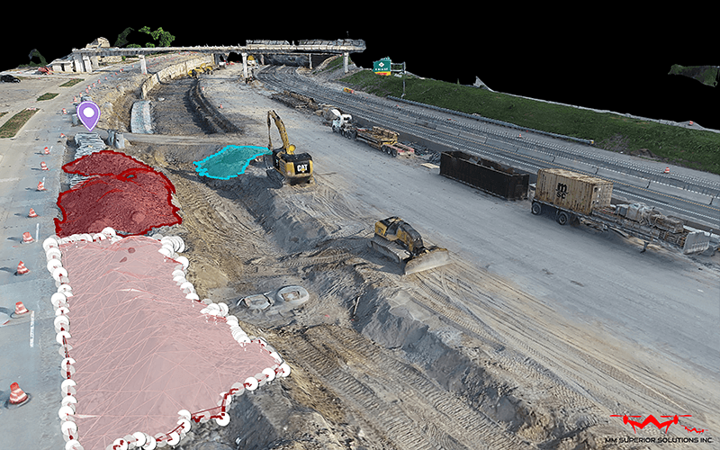
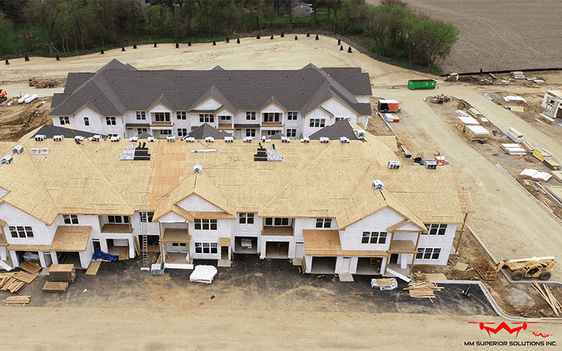
Superior Solutions is pleased to offer our ground-breaking 2D and 3D mapping solutions using drones for the construction industry.
Our mapping solutions are perfect for creating as-built drawings, progress reports, and land surveys. With our advanced mapping capabilities, you can rest assured that your construction project will be completed on time and within budget.
What is Site Mapping Construction?
Mapping construction sites is the process of creating a map or plan of a construction site. This map can show the location of buildings, roads, and other features on the site. It can also show the progress of the construction project.
2D and 3D Mapping with Drones
The first step when making a 3D or 2D map with drone aerial technology is to establish whether a map or model is needed, and then capture detailed aerial imagery. This imagery is then processed to create a digital map.
The accuracy of this map depends on the quality of the aerial imagery. It necessitates a high degree of accuracy and detail to ensure that all features on the construction site are captured. Drones will be used to create a 3D model of the area using hundreds of photos taken from different angles.
Why Use Drone Technology for Mapping?
The benefits of drones with 2D and 3D mapping services for construction sites are many. Some of these benefits include the following:
- Reduced time and money spent on site surveying
- Elimination of the need for ground teams for data collection
- Quick and easy deployment
- In-depth aerial coverage
2D and 3D Maps with MM Superior Solutions
Pix4d, Drone Deploy, Maps Made Easy, and other such sophisticated software solutions are used by MM Superior Solutions to develop our 2D and 3D maps. We use these cutting-edge techniques alongside photogrammetry, giving our drone mapping a wide range of applications in fields including archaeology, forestry management, cellular network planning, kaolin mines, and so much more.
2D and 3D Maps with MM Superior Solutions
Sophisticated software solutions are used by MM Superior Solutions to develop our 2D and 3D maps. We use these cutting-edge techniques alongside photogrammetry, giving our drone mapping a wide range of applications in fields including archaeology, forestry management, cellular network planning, kaolin mines, and so much more.
Our Process
To provide true orthomosaic and georeferenced maps that are cost-effective and timely, we employ high megapixel cameras on stabilized camera mounts. This aerial data is processed using software that enables us to create 2D maps, 3D models, and volumetric measurements.
The results are delivered as photorealistic renders and animations that can be used for presentations, client reports, and other purposes. This procedure would be almost impossible to replicate using a human piloting a physical aircraft—particularly with such a degree of detail accuracy.
Aerial Photography Benefits
Aerial photography has been used for many years in the mapping and surveying industry. However, the use of drones has added a new dimension to aerial photography.
The ability to give depth and perspective to a geographic area by means of 3D renderings, which are often used in visualizations, creates an enormous benefit for local authorities, consultancy, and telecommunication firms
Photogrammetry With Drones
Aerial photogrammetry is the process of extracting geometric information from photographs. This is done by taking a series of overlapping photos of an object or area from different angles.
These photos are then processed using software to create a 3D model or map. The accuracy of this map depends on the number of photos taken and the quality of the photos.
Orthomosaics have an absolute error of just half a meter on average thanks to the drone’s onboard GPS, but ground control points may be incorporated for centimetre precision. From police investigations to topographic mapping, our skilled drone pilots may use cutting-edge approaches to deliver highly precise photogrammetry for a wide range of applications.


